Trail Mountain bike La Haye - Autour du Mont Doville - Lahaye-du-Puits - Photo

Autour du Mont Doville - Lahaye-du-Puits

 tracegps
tracegps

User

© OpenStreetMap contributors
Length
Length
38 km
Max alt
Max alt
126 m
Uphill gradient
Uphill gradient
554 m
Km-Effort
Km-Effort  
46 km
Min alt
Min alt
5 m
Downhill gradient
Downhill gradient
554 m
Boucle
Boucle
Yes
Creation date :
2014-12-10 00:00:00.0
Updated on :
2014-12-10 00:00:00.0

(0 Reviews)

Mountain bike
Mountain bike
3h00
Difficulty : Difficult

Scan this QR Code to open this trail in the SityTrail application

FREE GPS app for hiking

Logo SityTrail SityTrail

IGN / Geographical institutes

Download SityTrail from the App Store Download SityTrail from Google Play

Logo SityTrail SityTrail World

The world is yours!

Download SityTrail from the App Store Download SityTrail from Google Play Download SityTrail on Huawei AppGallery

About

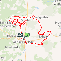
Trail Mountain bike of 38 km to be discovered at Normandy, Manche, La Haye. This trail is proposed by tracegps.

Description

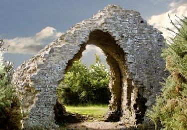
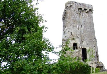
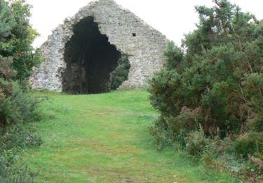
Si vous avez aimez les grimpettes, alors ce circuit est le votre. Ce parcours part de la Haye-du-Puits pour une boucle de 38,5 km qui vous emmènera sur le Mont Doville avec cette belle vue sur le massif armoricain. Vous passerez parmi les plus charmants gués et chemins creux du bocage à condition que le terrain soit bien sec, sinon vous allez galérer... Ce parcours est à faire en période où les pluies ne sont plus d'actualité, mis à part si vous adorez la boue. Bonne rando à tous. Mon site

Elevation profile

Photos

Positioning

Country:
France
Region :
Normandy
Department/Province :
Manche
Municipality :
La Haye
Location:
La Haye-du-Puits
Start:(UTM)
605909 ; 5461103 (30U) N.

Trails nearby

Trail Walking Doville - Boucle du Mont de Doville - Photo
Walking
prv

Walking

Very easy
(1)
Doville, Normandy, Manche, France
12.1 km | 14.7 km-effort
2h 32min
Yes
Trail Walking Doville - doville le 21 /09/2019 - Photo
Walking
jmp76700

Walking

Very easy
(1)
Doville, Normandy, Manche, France
10.8 km | 13.4 km-effort
3h 20min
No
Trail Walking Doville - Mont doville  - Photo
Walking
joelinou

Walking

Difficult
Doville, Normandy, Manche, France
12.5 km | 15.1 km-effort
3h 37min
No
Trail Walking Doville - Pédestre - Promenade et Randonnée Le Mont de Doville - Photo
Walking
neoroll44

Walking

Medium
Doville, Normandy, Manche, France
11.3 km | 14 km-effort
3h 10min
Yes
Trail Mountain bike La Haye - Le Mont Castre - La Haye du Puits - Photo
Mountain bike
tracegps

Mountain bike

Medium
La Haye, Normandy, Manche, France
13.4 km | 15.8 km-effort
1h 30min
Yes
Trail Walking Doville - Le Mont de Doville - Photo
Walking
tracegps

Walking

Medium
Doville, Normandy, Manche, France
11.3 km | 14 km-effort
4h 0min
Yes
Trail On foot Doville - Le Mont de Doville et les marais de la Sangsurière - Photo
On foot

On foot

Medium
Doville, Normandy, Manche, France
11.7 km | 14.4 km-effort
Unknown
Yes
Trail On foot Doville - Le Mont de Doville - Photo
On foot

On foot

Easy
Doville, Normandy, Manche, France
6.5 km | 7.3 km-effort
2h 0min
Yes
Trail Walking La Haye - 9 La Haye du Puits grande - Photo
Walking
guy77340

Walking

Very difficult
La Haye, Normandy, Manche, France
19.6 km | 23 km-effort
5h 14min
Yes


Close
My subscriptions